PREPARING FOR YOUR TRIP TO KING ASH BAY

At King Ash Bay we are very remote. We are 700km from the nearest traffic lights and 1,000km from the nearest shopping centre. With that being said, we are very well setup here. Many first time visitors are amazed at what we have to offer. This page was made to help give travellers a little bit more information about planning their trip.

Travelling here:

There are many ways to get to King Ash Bay Fishing Club. The way you decide to travel here will depend on many factors including how much time you have, your budget and the time of year.

Drive: Most people drive to King Ash Bay from all over Australia. You can take bitumen roads the entire way except for the last 21km. You will need to plan your trip and make sure you carry enough fuel, because there are some stretches of road that are several hundred kilometres between fuel stations.

You have a couple of options for driving to King Ash Bay.

From the Stuart Highway you can either head East from Three Ways just North of Tennant Creek, then North at Barkly Homestead to Cape Crawford or from Highway Inn at Daly Waters on the Carpentaria Highway towards Borroloola.                                                                                                                     If you want to drive on bitumen the whole way from Queensland you will cross the QLD – NT border just outside of Camooweal on the Barkly Highway heading West. At Barkly Homestead you will turn right onto the Tablelands Highway heading North. Even though the Tablelands and Carpentaria are called highways, they are in parts only single lane and you will have to pull over for trucks and road trains, as well as slowing down for cattle. You will arrive at the Heartbreak Hotel at Cape Crawford. From there you will head towards Borroloola, past the McArthur River Mine and then follow the signs to King Ash Bay. If you get to Bing Bong, you have gone too far.

In the middle of the dry season, the other popular way to get to King Ash Bay from Qld is via the Savannah Way. I guess you could call this the “scenic route”. It takes you along the Gulf or Carpentaria when heading here from Queensland. A lot of tourists come through the Savannah Way. It includes some creek crossings, a lot of dirt road driving and does get heavily corrugated. If you are traveling along the Savannah Way, then a stop over at King Ash Bay is essential.

Fly then Drive: Fly any of the major airlines into Darwin. From there, hire a car or a 4WD or camper and drive it to King Ash Bay. Depending on where you are travelling from, this can save you a couple of days travel at each side of your journey. It is a big drive to get from Darwin to King Ash Bay in one day, but people do it. We would recommend stopping overnight somewhere in between. Katherine, Daly Waters or Cape Crawford are all options.

Fly then Fly: The quickest way to get here, but also probably the most expensive. Fly to Darwin, then fly to the McArthur River Mine, then get picked up from there (Approx 1 hour drive from King Ash Bay). One of the airlines flying into the McArthur River Mine is AirNorth. There is also an airstrip at Borroloola and a dirt strip at King Ash Bay, but you would have to either charter a plane or pilot your own plane to use either of these air strips. Borroloola airstrip has a self service fuel facility.

“The Road”:

Whenever we refer to “the road” on this website or on our Facebook Page, we are referring to the 21km dirt road from the bitumen to King Ash Bay Fishing Club. During the wet season the road goes almost completely under water and very muddy and boggy. When the road is like that you would only use it with a very capable 4WD and only if 100% necessary. During the dry season the road is usable by all vehicles including 2WD sedans. It does get corrugated, but you just need to drive to the conditions. We regularly have road condition updates on our Facebook Page.

The Weather:

It’s going to be hot. All year round we experience warm to hot weather. During Winter the days are almost perfect, and not too humid. It is during Winter that King Ash Bay is at it’s busiest. Droves of Grey Nomads come up from down south to enjoy the warmer weather. Once the weather starts to get really hot and humid again in the lead up to the wet season, they all head back home.

What to Bring With You:

A lot of first-timers to King Ash Bay bring mountains of food and fuel with them. We have a privately owned Petrol Station here at King Ash Bay which includes a workshop and a very well stocked mini-mart/supermarket. The mini-mart has all of your essentials like fresh fruit & veg, meat, dry goods and even fishing gear and souvenirs. Another big surprise to our first-time visitors is the clubs Bar and Grill. The Bar and Grill are both open Thursday, Friday, Saturday & Sunday nights at the moment with reasonably priced drinks and meals. Due to Covid-19 restrictions and to protect our members and guests, social distancing will be requested.

Borroloola Region

While fishing is the main reason people come to King Ash Bay, the region has much more to offer.
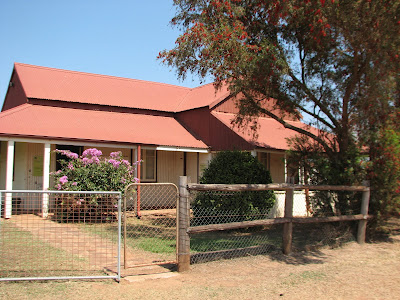
 

Considered a lawless frontier town when first gazetted in 1885, Borroloola is now the commercial centre of the region and the ‘seat’ for the Roper Gulf Shire.  The old police station was built in 1886.  It remains in excellent condition and is listed on the National Estate under control of the National Trust.  The building now houses a museum displaying the history of policing and other historical aspects of the region.

Short Video of the McArthur River Crossing at Borroloola.

Some information on the museum is available here:
https://sites.google.com/site/ntpmhsociety/our-rich-history/places/borroloola—historical

The aboriginal people of the region belong to four main tribal groups.   The Yanyuwa and Marra are referred to as ‘saltwater people’ and are associated with the Sir Edward Pellew Islands and the lower reaches of the McArthur and Limmen Rivers. The Gundanji and Garrawa people are known as ‘mainland or freshwater people’ and are associated with land to the south and east of the present township of Borroloola.  Gundanji lands include the site of the McArthur River Mine. Garrawa lands are near the Queensland border near Wollogorang Station and the Robinson River.

Borroloola draws it’s name from the aboriginal name of a nearby lagoon – Burrulula.

In recent years the McArthur River Mine, a zinc – lead mine owned by Xstrata Zinc has bought additional prosperity and employment to the area.


Carabirini Conservation Reserve

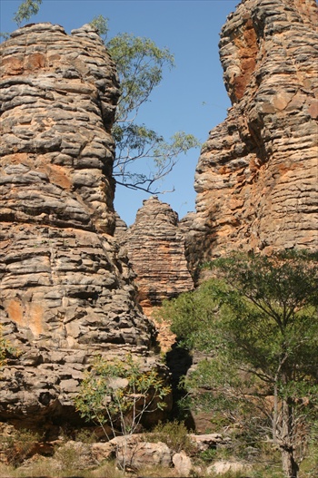
Caranbirini is located 46km south of Borroloola on the western edge of the Bukulara Range, just off the Carpentaria Highway (entrance is signposted on the Highway).  It incorporates sandstone escarpments, a semi-permanent waterhole with surrounding riverine vegetation and areas of open woodland. The waterhole is surrounded by 25 metre high sandstone spires known as a ‘Lost City’. There are short walks that allow you to explore the area.  Carabirini is easily accessible and is well worth a visit.
 

Waralungku Arts 

Waralungku Arts is an Aboriginal owned and controlled arts centre located in Borroloola. It is an enterprise of Mabunji Aboriginal Resource Association Incorporated (Mabunji).  Many of the artists have exhibited all over Australia in Darwin, Cairns, Sydney, Perth, Adelaide and Melbourne. In 2011 work from the centre was exhibited in London.  For more information, see their web site.
http://www.waralungku.com

Barranyi (North Island) National Park.

Part of the Sir Edward Pellew group of islands, Barranyi (North Island) is the traditional home of the Yanyuwa Aboriginal people.  The Park is Aboriginal freehold land and has been leased to the Northern Territory Government for management as a National Park.  Due to the isolation and lack of feral predators the Park is an important refuge for fauna. The island’s beaches provide an important nesting site for four species of marine turtle as well as a resting point for many species of migratory bird.
Camping – is available at Paradise Bay and Mud Bay.  Facilities are limited –

For further information, visit the NT Government website
http://www.nretas.nt.gov.au/national-parks-and-reserves/parks/find/barranyi


Poppy’s Pools
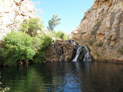
These thermal pools are situated 70 kilometers from Cape Crawford on Bauhinia Downs Station, traditional land of the Gundanji people.  The hot spring water rises under pressure from a large aquifer system 5-7 km’s deep in the earths crust. It emerges to the surface through permeable faulted sandstone rock of the Roper Group, where it cools as it moves downstream and mixes with the water from the cool spring.

Access to the pools is by helicopter from Cape Crawford or by road.  A permit is required and fees apply.
Wildlife and Flora

The McArthur Region is a tough environment for flora and fauna.  A long dry season, with long days of searing sun, cool nights and almost no moisture is followed by the hot, humid rainy and sometimes cyclonic wet season.  The area’s native plants and animals are well adapted to cope with this environment.

There is a large variety of bird life, but a keen eye is needed to spot and appreciate some of the smaller breeds as they often don’t travel far from the cover of long grass and thick bushes.  Early morning and evening is feeding time and the best opportunity to spot some of the more skittish breeds.

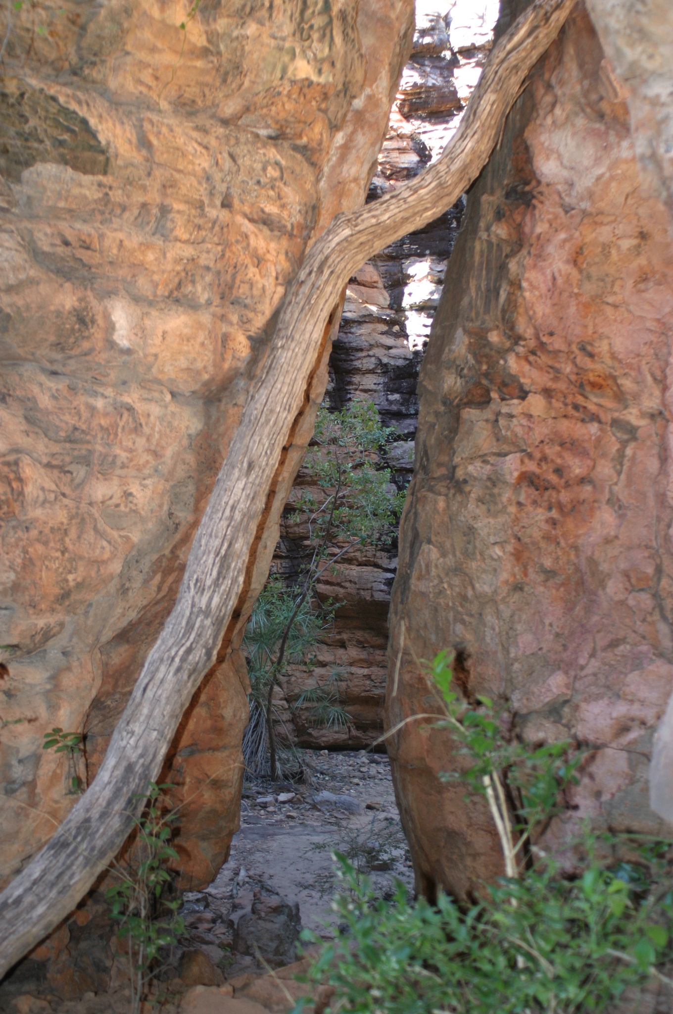
The following pictures are just a small sample of the wildlife and flora of the region.


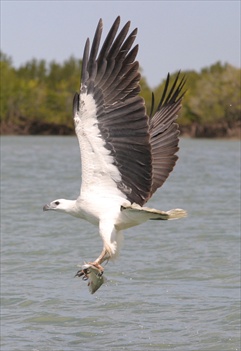
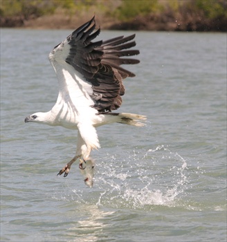
What a sight!  The enormous and beautiful Sea Eagle swoops down near your boat to catch a fresh lunch.  Sea Eagles are a common sight in the area.


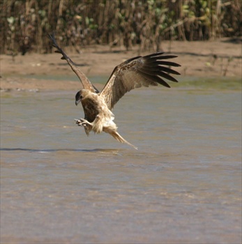
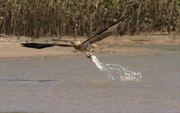
Not wishing to be outdone, the Whistling Kite puts on it’s own show.


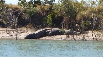
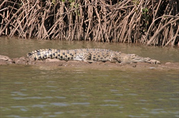
Unfortunately swimming in the river is not recommended.  We live in harmony with the crocodiles by leaving the swimming to them.


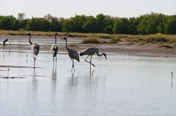
The Brolga is one of two types of Crane found in Australia, while the Jabiru is Australia’s only member of the Stork family.  Both of these beautiful birds are found in abundance in the McArthur River area.


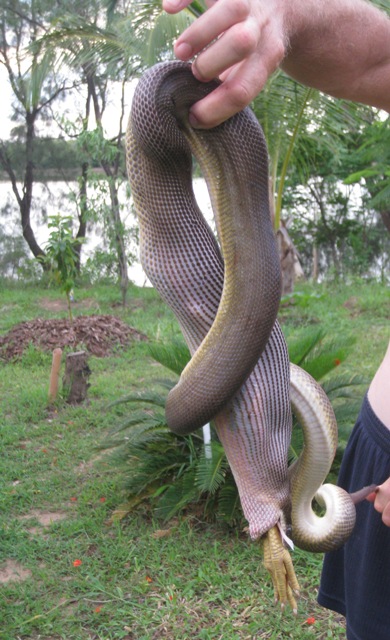
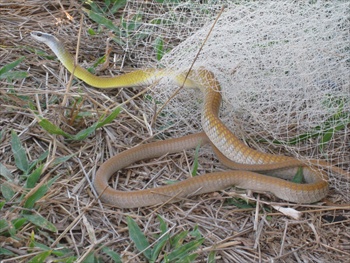
Naturally, snakes are also fairly common in our area.  Like most wildlife if they are left alone, they go about their business and let us go about ours.  The python on the left managed to get into a chook shed at one of the KAB residences. Having swallowed a chook, it could not escape.  The snake was released unharmed.  Unfortunately the chook did not survive the ordeal.  The tree snake on the right got caught in a cast net left out to dry.  He also was released unharmed.


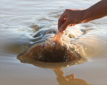
The Groper is responsible for many a ‘one that got away’ fishing tale.

A group of very large Groper regularly spend time in the shallows near our un-powered camp area.  With care, it is sometimes possible to feed these magnificent  sea monsters by hand.


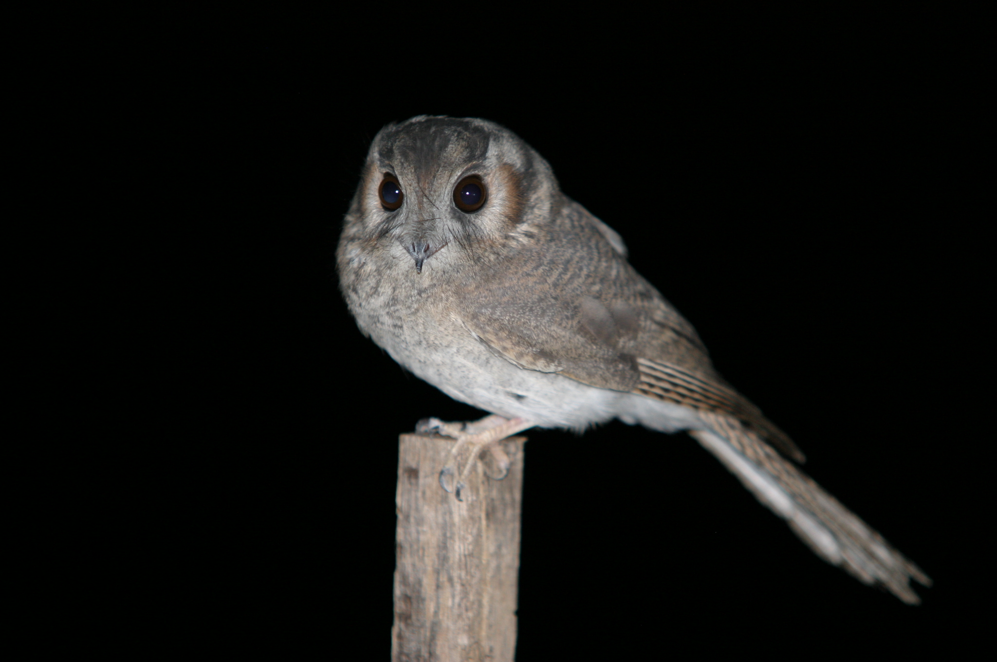
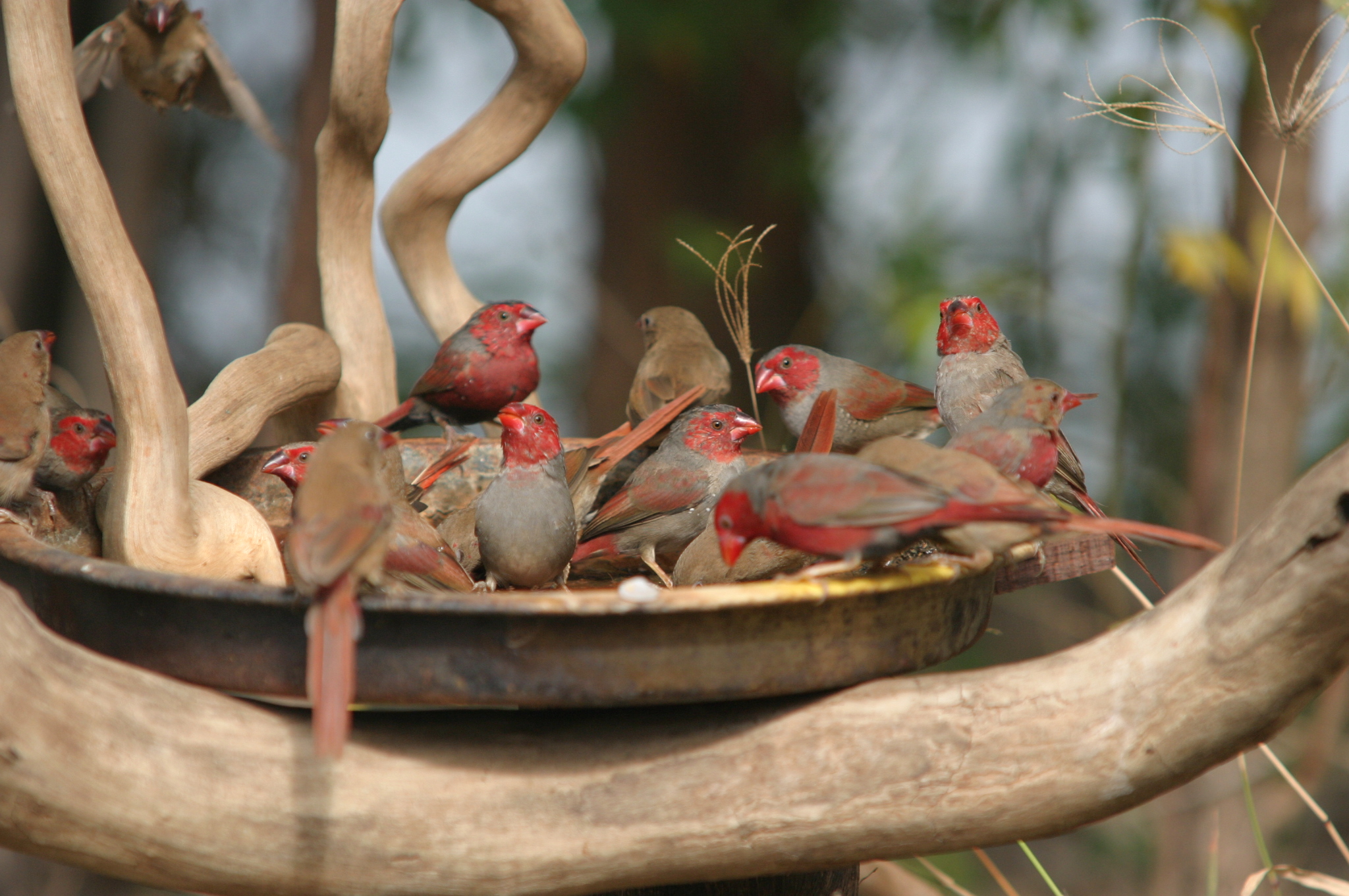
The Australian Owlet -Nightjar (left) is one of a number of owls active at night.  Along with the Double – barred finch, the Crimson Finch (right) are the most common of the finches found in our area.  These ones are enjoying a cool bath on a hot day.